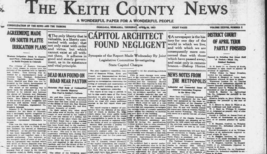
The front-page April 26, 1923, Keith County News story in the left column told of Colorado and Nebraska officials’ conclusion of the South Platte River Compact in Ogallala six days earlier.
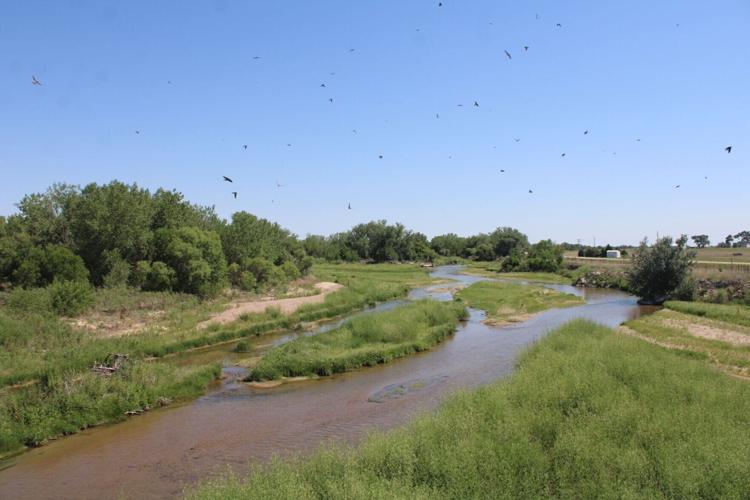
Birds soar in late June over the South Platte River’s main canal south of Julesburg, as seen in this photo looking eastward from the U.S. Highway 385 bridge near Interstate 76. The U.S. Geological Survey gage that serves as the 1923 South Platte River compact’s official gage is located near this spot. Though the river was flowing Tuesday, its official flow of 44.9 cubic feet per second remained well below the 120 cfs minimum that the compact requires Colorado to deliver to Nebraska from April 1 to Oct. 15. The threshold has yet to be met this irrigation season.
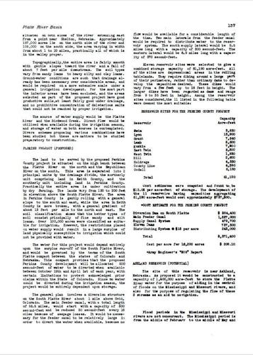
This page from the Nebraska State Planning Board’s final “Water Resources of Nebraska” report of February 1941 represents the only known call for state action to complete the 1894 Perkins County Canal between the South Platte River Compact’s 1926 ratification by Congress and former Gov. Pete Ricketts’ public revival of the project in January 2022. The Perkins canal recommendation first appeared in the report’s first draft in January 1937.
Telegraph special projects reporter Todd von Kampen has been tracking Nebraska's plans to revive and complete the 1894 Perkins County Canal since soon after then-Gov. Pete Ricketts proposed it in January 2022.
Nebraska can only guarantee that Colorado sends the state the South Platte River water it’s entitled to by exercising its right to finish the 1894 Perkins County Canal, Gov. Pete Ricketts said Friday morning in North Platte.
In 1894, Perkins County residents began work on an ill-fated South Platte River canal from Ovid, Colorado, into Nebraska, the remnants of which can be seen today, if you know where to look.
Now Colorado leaders are looking up Interstate 76, contemplating ways to use that water and even pipe it back to the Denver area. That’s why Nebraska officials are reconsidering the 127-year-old canal that started near present-day Ovid but never made it into Nebraska back then.
Senators voted 38-6 to pass the “STAR WARS” committee measure, and 42-4 to invoke Nebraska’s right under the 1923 South Platte River Compact to finish the 1894 Perkins County Canal.
Here’s a recap of key spending items primarily affecting western Nebraska or introduced by the region’s five state senators in the Legislature’s 2023-25 two-year budget package.
As Nebraska commits itself to the Perkins County Canal, a Telegraph analysis shows river flows at Julesburg have exceeded South Platte River Compact guarantees 40% of the time since 1926.
A Keith County Fairgrounds open house featured a Nebraska Department of Natural Resources update on reviving the Perkins County Canal, allowed under the compact concluded in Ogallala in 1923.
Nebraska water leaders told a packed Ogallala information meeting Friday that they hope a revived and completed Perkins County Canal can make at least partial use of Keith County canals.
The Telegraph opens a two-part series on Nebraska's U.S. Supreme Court lawsuit against Colorado by analyzing 99 years of state-line South Platte River flows under the South Platte River Compact.
Cornhusker State leaders have their eyes on all those Colorado upstream wells — thousands of them — that take massive draughts from an underground river: the aquifer.
The Telegraph's latest reporting on the proposed Perkins County Canal revival features a revised historical analysis of how much water the canal might have carried over the past 99 years.
Nearly 200 people packed an Ogallala conference room as Nebraska officials presented their preferred 60-mile route across parts of two states to complete the 1894 Perkins County Canal.
U.S. Army Corps of Engineers officials heard unhappiness over the 1894 Perkins County Canal's revival in Julesburg during their second of three open houses in Colorado and Nebraska this week.
The U.S. solicitor general urged the Supreme Court to assert original jurisdiction over Nebraska’s lawsuit accusing Colorado of falling short of required spring-summer flows under the South Platte River Compact.
Birds soar in late June over the South Platte River’s main canal south of Julesburg, as seen in this photo looking eastward from the U.S. Highway 385 bridge near Interstate 76. The U.S. Geological Survey gage that serves as the 1923 South Platte River compact’s official gage is located near this spot. Though the river was flowing Tuesday, its official flow of 44.9 cubic feet per second remained well below the 120 cfs minimum that the compact requires Colorado to deliver to Nebraska from April 1 to Oct. 15. The threshold has yet to be met this irrigation season.
The front-page April 26, 1923, Keith County News story in the left column told of Colorado and Nebraska officials’ conclusion of the South Platte River Compact in Ogallala six days earlier.
This page from the Nebraska State Planning Board’s final “Water Resources of Nebraska” report of February 1941 represents the only known call for state action to complete the 1894 Perkins County Canal between the South Platte River Compact’s 1926 ratification by Congress and former Gov. Pete Ricketts’ public revival of the project in January 2022. The Perkins canal recommendation first appeared in the report’s first draft in January 1937.