


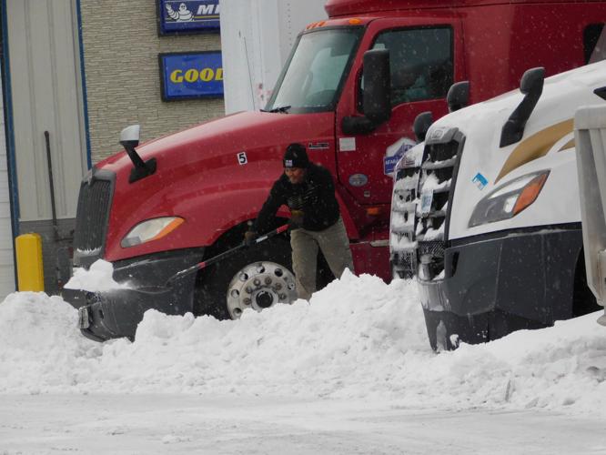
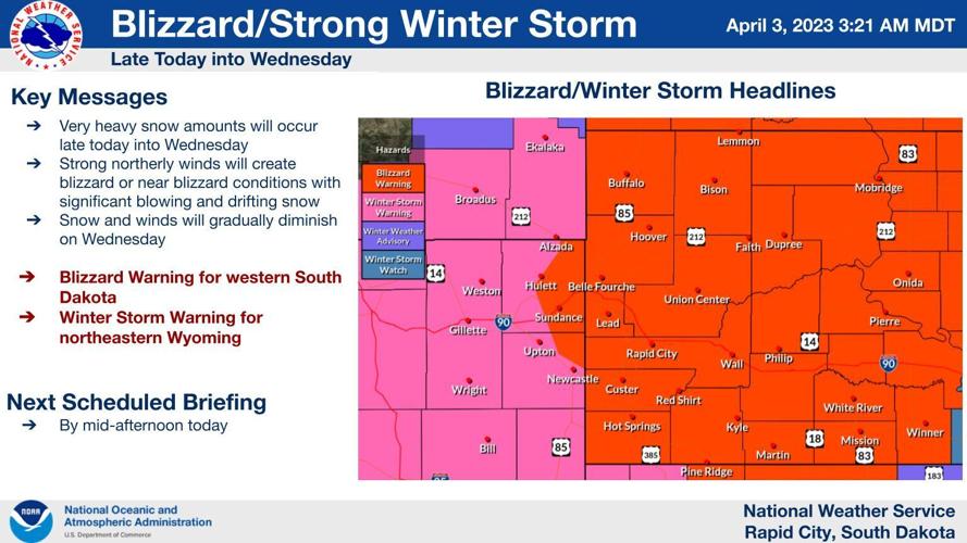
After a mild and sunny weekend, another round of winter weather is on the way, this time bringing significant snowfall and high winds, and prompting the National Weather Service to issue blizzard warnings across western South Dakota.
Snowfall amounts of one to two feet are likely, with areas in the Northern Hills looking at 24 to 36 inches. For Rapid City, a foot to 18 inches is possible. Locally, heavier amounts should be expected across the area.
According to the National Weather Service, the heaviest snowfall should occur late Monday night into Tuesday morning. Accumulation and blowing snow should taper off Wednesday.

Blizzard warnings extend across Western South Dakota and into Nebraska, Wyoming and North Dakota Monday. A powerful storm is expected to dump nearly two feet of snow across the area by Wednesday morning, with high winds likely to create blizzard conditions.
Most of western South Dakota will see winds from 50 to 60 miles per hour, causing blizzard conditions and making travel not only difficult, but dangerous and likely impossible at times.
South Dakota State Fire Meteorologist Dr. Darren Clabo said in a Twitter post that he wouldn't compare this incoming storm to Winter Storm Atlas (October 2013), calling this storm "huge, but different."
People are also reading…
"This will be one of the worst snow storms central/western SD has will have seen in [a] decade," Clabo wrote. "Blizzard conditions, impossible travel and all of it during calving season. Prepare for a long duration shutdown."
In response to the incoming severe threat, the Pennington County Sheriff's Office, Rapid City Police Department, Rapid City Fire Department and South Dakota Highway Patrol held a briefing Monday morning to warn locals and encourage forward-thinking preparation.
Pennington County Sheriff's Office Patrol Capt. Chris Hislip said storms of this magnitude require a ton of planning and interdepartmental cooperation.

Left to right: Rapid City Fire Department EMS Division Chief Brent Long, South Dakota Highway Patrol Field Operations Lieutenant Zac Bader, Pennington County Sheriff's Office Patrol Captain Chris Hislip, and Rapid City Police Department Patrol Lieutenant Chris Holbrook.
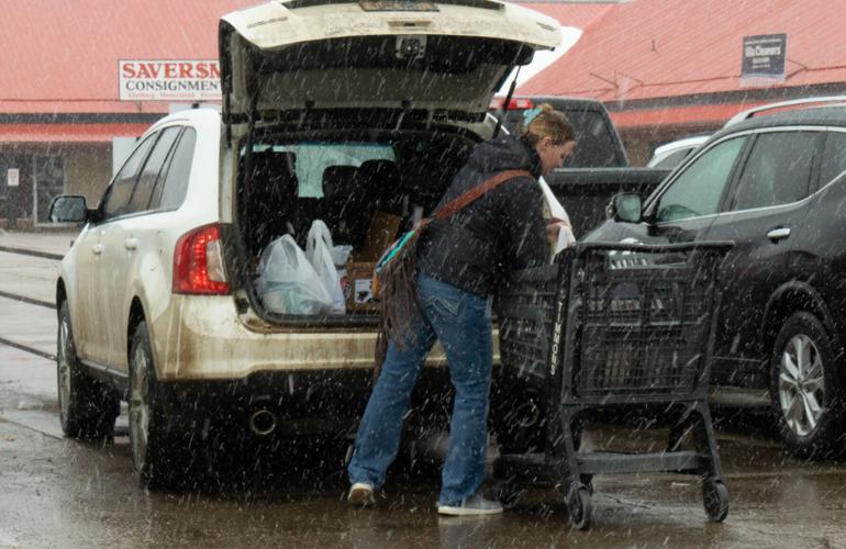
"Plan ahead," said Chris Holbrook, patrol lieutenant, Rapid City Police Department. "Get to the store early today, if possible. Take care of all the necessities to prepare for the next couple of days, and know that if the roads become impassible in Rapid City for you, they are likely impassible for us as well, so bear that in mind before making the decision to venture out."
South Dakota Highway Patrol Field Operations Lieutenant Zac Bader addressed potential interstate closures, advising that secondary routes should be considered unsafe at the same time.
"If people don't adhere to the no travel advisories, it takes priority away from DOT to do their actual job," he said. "Now they have to assist us in rescue operations, which takes away from the other duties that they have."
Interstate 90 (both directions) is scheduled to close from the Wyoming state line to Wall (Exit 110) beginning at 8 p.m. Monday.
Conditions are forecasted to continually deteriorate overnight, with travel becoming extremely difficult to impossible. As the storm continues to move across the state, Interstate closures are expected to be extended, with multi-day closures anticipated.
Due to the expected length of this winter weather event, all motorists are advised to plan accordingly due to limited accommodations and truck parking in the communities of Wall, Kadoka, Murdo, Vivian and Chamberlain.
Interstate 90 within the Rapid City metro area (exit 55 to exit 67) will be open for local travel.

Plows sit at the DOT's Regional Office in Rapid City ready to be deployed during this week's winter storm.
Anyone stranded out in the storm or needing assistance should expect delayed response times due to the weather.
"That response will definitely be delayed," Hislip said. "With blizzard-like conditions, no matter what vehicles you have, if you're out and you can't see where you're driving, that's a problem for anybody. Just heed the warnings and stay at home."

Pennington County Sheriff's Office Patrol Capt. Chris Hislip addresses media during a winter storm briefing on Monday, April 3.
The winter weather forecast is forcing Rapid City offices to close on Tuesday.
City Hall, Rapid City Landfill, Rapid Transit System’s RapidRide and Dial-A-Ride operations, Rapid City Public Library, Roosevelt Swim Center, Roosevelt Park Ice Arena and The Monument will be closed.
There will be no city trash collections on Tuesday. The city plans to reopen on Wednesday and resume route collections where crews left off at the end of Monday. All recycling routes will be suspended until next week.
Box Elder City Hall will also be closed Tuesday, April 4, due to the anticipated severe weather. The City Council meeting has been rescheduled for Thursday, April 6.
If travel conditions become unsafe for Box Elder road crews, winter maintenance activities may be suspended for a time and will resume as soon as it is safe to do so. City snow plowing is prioritized for Snow Emergency Routes as a primary focus.
Residents are encouraged to limit street parking where practical or required by law. The City may utilize short-term staging areas to temporarily pile snow in some areas, such as cul-de-sacs, for later removal.
Make sure you have a way to receive updates on the forecast, watches and warnings. The National Weather Service in Rapid City provides regular updates on its website (weather.gov/unr), Facebook page (NWS Rapid City) and Twitter (@NWSRapidCity). The NOAA Weather Radio livestream is available online at weatherusa.net/radio. Road conditions are available by calling 5-1-1 or visiting sd511.org.


